University of Leicester
Type of resources
Topics
Keywords
Contact for the resource
Provided by
Years
Formats
Representation types
Update frequencies
Scale
Resolution
-
This dataset for the UK, Jersey and Guernsey contains the Corine Land Cover (CLC) revised for 2006. This shapefile has been created from combining the 2006 land cover layers from the individual CLC database files for the UK, Jersey and Guernsey. CLC is a dataset produced within the frame of the Initial Operations of the Copernicus programme (the European Earth monitoring programme previously known as GMES) on land monitoring. CLC provides consistent information on land cover and land cover changes across Europe. This inventory was initiated in 1985 (initial year 1990) and then established a time series of land cover information with updates in 2000 and 2006 the last one being the 2012 reference year. CLC products are based on the analysis of satellite images by national teams of participating countries - the EEA member and cooperating countries - following a standard methodology and nomenclature with the following base parameters: * 44 classes in the hierarchical three level Corine nomenclature; * Minimum mapping unit (MMU) for status layers is 25 hectares; * Minimum width of linear elements is 100 metres; The resulting national land cover inventories are further integrated into a seamless land cover map of Europe. Land cover and land use (LCLU) information is important not only for land change research, but also more broadly for the monitoring of environmental change, policy support, the creation of environmental indicators and reporting. CLC datasets provide important datasets supporting the implementation of key priority areas of the Environment Action Programmes of the European Union as protecting ecosystems, halting the loss of biological diversity, tracking the impacts of climate change, assessing developments in agriculture and implementing the EU Water Framework Directive, among others. Full details about this dataset can be found at https://doi.org/10.5285/2d0cf17f-aabd-4be6-859b-55c3403bbd9a
-
The data set consists of rock samples collected from Burnmouth, a core drilled at Norham, from Crumble Edge, Willie's Hole and Nova Scotia from 2012-2016; milled material is included. There is an Excel spreadsheet of sample numbers with location, sample height on log, lithology and fossil content. Scans of field logs from Burnmouth, Crumble Edge, Edington Mill, Pease Bay (UK) and locations in Nova Scotia, and overview drawn-up logs from Burnmouth, Norham, Crumble Edge and Willie's Hole are included. Scans of thin section scans are also included. There is a spreadsheet containing geochemistry data - sample numbers with lithology and %C, %S, d13C. These data were used to interpret the environment in which early tetrapods have been found in the early Carboniferous. Publications include: Bennett et al., 2016 (doi: 10.1111/sed.12280); Bennett et al., 2017 (http://dx.doi.org/10.1016/j.palaeo.2016.12.018 0031-0182); Clack et al., 2016, (DOI: 10.1038/s41559-016-0002); Kearsey et al., 2016 (http://dx.doi.org/10.1016/j.palaeo.2016.05.033) ; Clack et al., 2018, (doi:10.1017/S1755691018000087); Millward et al., 2018 (doi: 10.1111/sed.12465); Ross et al., 2018 (https://doi.org/10.1017/S1755691018000142)
-
This study explored the links between host rock composition, hydrothermal fluid composition (particularly pH), and the resulting ore minerals and deposits. The progressive water–rock reaction between 1 kg of initially acidic, condensed magmatic vapour and a series of different rock compositions was modelled with CHILLER (Reed, 1982, Reed, 1998), and follows the design of the water-rock reactions of Reed (1997). The thermodynamic data used in the numerical experiments are from the database SOLTHERM.H08 (Reed and Palandri, 2013). Data and calculations within SOLTHERM include: equilibrium constants calculated with SUPCRT92 (Johnson et al., 1992); mineral thermodynamic data for silicates, oxides, hydroxides, carbonates, gases (Holland and Powell, 1998) and sulphides (Shock, 2007). Mineral solid solutions are represented by end-member compositions that are mixed using an ideal multisite mixing scheme. Rock compositions used in the modelling represent a sub-alkaline andesitic control, and a number of alkaline compositions associated with world-class Au deposits. All starting rock compositions are derived from whole rock geochemical data, and have been recalculated to a 100% basis without TiO2 or P2O5 (excluded as minor phases with little to no effect on hydrothermal mineral assemblages). Original total Fe (as Fe2O3) has been recalculated to FeO and Fe2O3 using the method of Müller et al. (2001). The andesite is representative of calc-alkaline, silica saturated compositions, and is derived from and discussed in detail in Reed (1997). The Luise “Phonolite” (a trachyandesite using the Le Maitre et al., 1989 TAS plot; Fig. 1) and Trachyandesite are from the vicinity of the Ladolam epithermal Au deposit, Lihir Island, Papua New Guinea (Müller et al., 2001). The Porgera Mugearite and Feldspar Porphyry represent unaltered host rock compositions (Richards, 1990) from the Porgera Au deposit (Papua New Guinea). The Cripple Creek Phonolite is part of the host suite to the Cripple Creek epithermal Au deposit, Colorado (Kelley et al., 1998). The Savo trachyte (Smith et al., 2009) represents a typical host rock of the active hydrothermal system (Smith et al., 2010), on Savo island, Solomon Islands. With the exception of the Andesite, all compositions are alkaline using the total alkali versus silica definition of Irvine and Baragar (1971). The Savo sample is not associated with known epithermal Au mineralisation; this composition was selected on the grounds that it represents an evolved (SiO2-rich) silica-saturated, alkaline composition. The initial fluid composition is based on a condensate from Augustine volcano (Symonds et al., 1990) mixed 1:10 with pure water (Reed, 1997; Table 2). A single starting fluid for all models was chosen so as to demonstrate the effect of host rock alone.
-
The data set consists of rock samples collected from Coquetdale, Coldstream and Whitrope Burn from 2013-2014; milled material is included. There is an Excel spreadsheet of sample numbers with location, sample height on log, d13C data and %C. There are scans of field logs from Coquetdale, Coldstream and Whitrope Burn, and Illustrator drawn logs from Coldstream which include samples collected at a later date. Scans of thin sections are also included. (thin sections to be kept at Leicester for the time being – still being worked on for papers.) Each locality folder has an Excel spreadsheet detailing samples, sample height, %C and bulk and specific d13C values. These data were used to interpret the environment in which early tetrapods have been found in the early Carboniferous. These data supported the MPhil thesis 'In an alternating marine and non-marine depositional setting, where and how are early Carboniferous tetrapods preserved?' by Sherwin, 2018, and one publication including data from Whitrope Burn - Richards et al., 2018, (https://doi.org/10.1017/S1755691018000166).
-
This dataset is the 2018 Corine Land Cover map, consisting of 44 classes in the hierarchical three level Corine nomenclature. Corine Land Cover (CLC) 2018, CLC change 2012-2018 and CLC 2012 revised are three of the datasets produced within the frame of the Copernicus programme on land monitoring. Corine Land Cover (CLC) provides consistent information on land cover and land cover changes across Europe; these two maps are the UK component of Europe. This inventory was initiated in 1985 (reference year 1990) and established a time series of land cover information with updates in 2000, 2006 and 2012 being the last iteration. CLC products are based on photointerpretation of satellite images by national teams of participating countries – the EEA member and cooperating countries – following a standard methodology and nomenclature with the following base parameters: 44 classes in the hierarchical three level Corine nomenclature; minimum mapping unit (MMU) of status layers is 25 hectares; minimum width of linear elements is 100 metres; minimum mapping unit (MMU) for Land Cover Changes (LCC) for the change layers is 5 hectares. The resulting national land cover inventories are further integrated into a seamless land cover map of Europe. Land cover and land use (LCLU) information is important not only for land change research, but also more broadly for the monitoring of environmental change, policy support, the creation of environmental indicators and reporting. CLC datasets provide important datasets supporting the implementation of key priority areas of the Environment Action Programmes of the European Union as protecting ecosystems, halting the loss of biological diversity, tracking the impacts of climate change, assessing developments in agriculture and implementing the EU Water Framework Directive, among others. More information about the Corine Land Cover (CLC) and Copernicus land monitoring data in general can be found at http://land.copernicus.eu/. Full details about this dataset can be found at https://doi.org/10.5285/084e0bc6-e67f-4dad-9de6-0c698f60e34d
-
This dataset is the Corine Land Cover (CLC) change map between 2012 and 2018, consisting of 44 classes in the hierarchical three level Corine nomenclature. The Corine land cover changes between 2012 and 2018 for the UK, Isle of Man, Jersey and Guernsey dataset forms part of the Corine Land Cover Maps collection and is produced within the frame of the Copernicus programme on land monitoring. Corine Land Cover (CLC) provides consistent information on land cover and land cover changes across Europe; this change map is the UK component of the European coverage. This inventory was initiated in 1985 (reference year 1990) and established a time series of land cover information with updates in 2000, 2006 and 2012 being the last iteration. CLC products are based on photointerpretation of satellite images by national teams of participating countries – the EEA member and cooperating countries – following a standard methodology and nomenclature with the following base parameters: 44 classes in the hierarchical three level Corine nomenclature; minimum mapping unit (MMU) of status layers is 25 hectares; minimum width of linear elements is 100 metres; minimum mapping unit (MMU) for Land Cover Changes (LCC) for the change layers is 5 hectares. The resulting national land cover inventories are further integrated into a seamless land cover map of Europe. Land cover and land use (LCLU) information is important not only for land change research, but also more broadly for the monitoring of environmental change, policy support, the creation of environmental indicators and reporting. CLC datasets provide important datasets supporting the implementation of key priority areas of the Environment Action Programmes of the European Union as protecting ecosystems, halting the loss of biological diversity, tracking the impacts of climate change, assessing developments in agriculture and implementing the EU Water Framework Directive, among others. More information about the Corine Land Cover (CLC) and Copernicus land monitoring data in general can be found at http://land.copernicus.eu/. Full details about this dataset can be found at https://doi.org/10.5285/027b6432-f44d-41ab-b349-89fae673d5f5
-
This dataset for the UK, Jersey and Guernsey contains the Corine Land Cover (CLC) changes between 2006 and 2012. This shapefile has been created by combining the land cover change layers from the individual CLC database files for the UK, Jersey and Guernsey. CLC is a dataset produced within the frame of the Initial Operations of the Copernicus programme (the European Earth monitoring programme previously known as GMES) on land monitoring. CLC provides consistent information on land cover and land cover changes across Europe. This inventory was initiated in 1985 (initial reference year 1990) and then established a time series of land cover information with updates in 2000 and 2006 with the last one being for the 2012 reference year. CLC products are based on the analysis of satellite images by national teams of participating countries - the EEA member and cooperating countries - following a standard methodology and nomenclature with the following base parameters: - 44 classes in the hierarchical three level Corine nomenclature - Minimum mapping unit (MMU) for Land Cover Changes (LCC) for the change layers is 5 hectares. The resulting national land cover inventories are further integrated into a seamless land cover map of Europe. Land cover and land use (LCLU) information is important not only for land change research, but also more broadly for the monitoring of environmental change, policy support, the creation of environmental indicators and reporting. CLC datasets provide important information supporting the implementation of key priority areas of the Environment Action Programmes of the European Union as protecting ecosystems, halting the loss of biological diversity, tracking the impacts of climate change, assessing developments in agriculture and implementing the EU Water Framework Directive, among others. Full details about this dataset can be found at https://doi.org/10.5285/35fecd0f-b466-448b-94d1-0bba90be450e
-
This dataset for the UK, Jersey and Guernsey contains the Corine Land Cover (CLC) for 2012 (CLC2012). This dataset has been created from combining the 2012 land cover layers from the individual CLC files for the UK, Jersey and Guernsey. CLC is a dataset produced within the frame of the Initial Operations of the Copernicus programme (the European Earth monitoring programme previously known as GMES) on land monitoring. CLC provides consistent information on land cover and land cover changes across Europe. This inventory was initiated in 1985 (initial year 1990) and then established a time series of land cover information with updates in 2000 and 2006 the last one being the 2012 reference year. CLC products are based on the analysis of satellite images by national teams of participating countries - the EEA member and cooperating countries - following a standard methodology and nomenclature with the following base parameters: - 44 classes in the hierarchical three level Corine nomenclature; - Minimum mapping unit (MMU) for status layers is 25 hectares; - Minimum width of linear elements is 100 metres; The resulting national land cover inventories are further integrated into a seamless land cover map of Europe. Land cover and land use (LCLU) information is important not only for land change research, but also more broadly for the monitoring of environmental change, policy support, the creation of environmental indicators and reporting. CLC datasets provide important datasets supporting the implementation of key priority areas of the Environment Action Programmes of the European Union as protecting ecosystems, halting the loss of biological diversity, tracking the impacts of climate change, assessing developments in agriculture and implementing the EU Water Framework Directive, among others. Full details about this dataset can be found at https://doi.org/10.5285/32533dd6-7c1b-43e1-b892-e80d61a5ea1d
-
Publications linked to the Grant: Holwell DA, Keays RR, McDonald I and Williams MR. 2015. Extreme Enrichment of Se, Te, PGE and Au in Cu sulfide microdroplets: evidence from LA-ICP-MS analysis of sulfides in the Skaergaard Intrusion, East Greenland Contribution to Mineralogy and Petrology. doi: 10.1007/s00410-015-1203-y. 2) Smith JW, Holwell DA, McDonald I, Boyce AJ. 2016. The application of S isotopes and S/Se ratios in determining ore-forming processes of Magmatic Ni-Cu-PGE sulfide deposits: a cautionary case study from the northern Bushveld Complex Ore Geology Reviews, 73, 148–174 10.1016/j.oregeorev.2015.10.022. Jenkin GRT, Al-Bassam AZM, Harris, RC, Abbott, AP, Smith DJ, Holwell DA, Chapman RJ and Stanley CJ. 2015. The application of Deep Eutectic Solvent Ionic liquids for environmentally friendly dissolution and recovery of precious metals. Minerals Engineering, doi: 10.1016/j.mineng.2015.09.026. Hughes, H. S.R., McDonald, I., Faithfull, J. W., Upton, B. G..J., and Loocke, M. (2016) Cobalt and precious metals in sulphides of Peridotite Xenoliths and inferences concerning their distribution according to geodynamic environment: a case study from the Scottish lithospheric mantle. Lithos, 240-3, pp. 202-227. doi:10.1016/j.lithos.2015.11.007. Abbott, A.P., Harris, R.C., Holyoak, F., Frisch, G., Hartley, J. and Jenkin, G.R., 2015. Electrocatalytic recovery of elements from complex mixtures using Deep Eutectic solvents. Green Chemistry, 17(4), pp.2172-2179. DOI: 10.1039/C4GC02246G
-
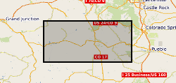
Whole rock and microanalytical geochemistry data from rocks collected from the Colorado Mineral Belt, Thirtynine Mile volcanic area, Cripple Creek gold deposit (& environs) and other volcanic and intrusive bodies of the Pikes PEak - Gunnison area of Colorado.
 NERC Data Catalogue Service